The GeoCanoas Project is a Geographic Information System (GIS) with a wide set of integrated tools based in location intelligence to provide services and information for the local administration and its citizens, available in a public web portal. In it, it is possible to issue a zoning certificate, make a prior consultation of the viability of enterprises, as well as provide maps and information related to the environment, education, urban development, economic development, transport and mobility, public safety, health and obtaining plants. allotments or zoning certificate available for download and printing.
In addition, it allows urban and environmental planning by public agents, providing information from various areas of public administration to city managers. The collection of information generated by the platform is available to the public, which allows the population to follow the works carried out in the municipality, the projects, the location of public equipment, value plan, history of satellite images, infrastructure, among others, giving thus more transparency to the municipal administration.
This tool shows the location of the various public facilities, distributed in intuitive tabs on the portal, being a widely used guide, available for citizens to locate or track public works.
Environment
This resource brings information for the planning and management of the environment in the municipality, with webmaps that cover water resources, permanent preservation areas, natural and urban parks, among others.
Infrastructure
This tool shows the availability and location of the most important elements that make up the city's infrastructure, such as bicycle lanes, flood protection system, road network, gas pipelines, oil pipelines and fixed telephone towers in the city.
Urbanism and Housing
Reduces processes through online viability and zoning certificate, indicating the guidelines of the Urban and Environmental Master Plan. It also provides topography, land subdivisions and urban sprawl over the decades.
UNDERSTAND GEOCANOAS OPERATION
CASES ON USING THE PLATFORM
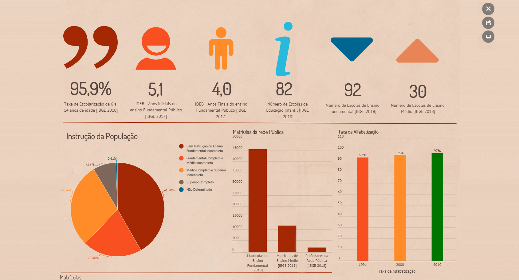
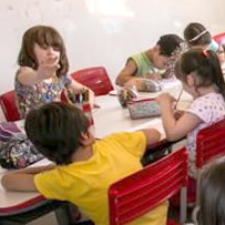
Child education
The kindergarten webmap allows decision making targeting places in municipal education through metrics.
To assist in better meeting municipal demand by increasing the number of places available in kindergarten, the GEOCANOAS team produced a webmap with graphs of supply and demand of enrollment by neighborhood, location of day care centers and municipal preschools, as well as available public areas. for the implementation of new schools.
Using this information, it was possible to strategically define the best place for the allocation of new schools, having today the construction of the Mato Grande and Central Park EMEIs as one of the main results of the project.
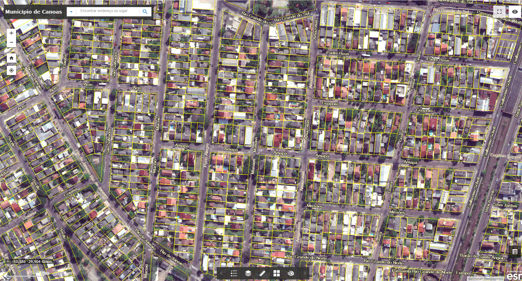
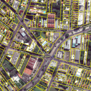
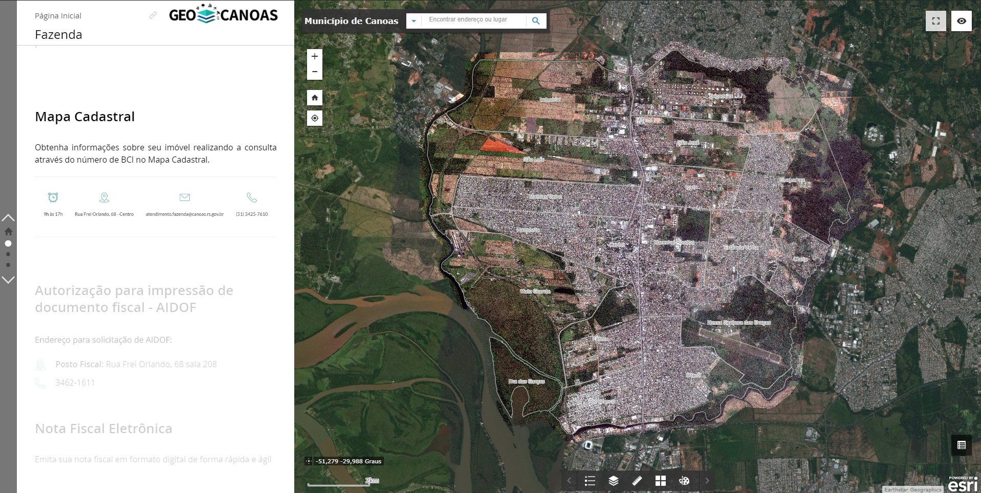
The Cadastral Map has georeferenced information of lots in the municipality and its registration information. The area can be found by searching by the BCI number or by the property address. By clicking on the area of interest, you can quickly access information such as real estate registration, land area, neighborhood, block, lot, tax region and subdivision to which it belongs.
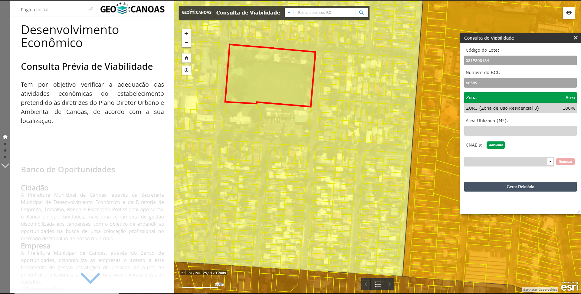
Feasibility Consultation
The simulation of prior feasibility consultation for Legal Entities and MEI is used to obtain information related to the feasibility of installing a particular activity in the selected location, in accordance with the Municipal Urban Environmental Master Plan.
Zoning Certificate
The zoning certificate is the document issued by the city hall that indicates the parameters of the PDUA in relation to the location of the property. It allows the online consultation of the zones that make up a particular location, obtaining the percentage and information of each zone according to the Municipal Urban Environmental Master Plan.
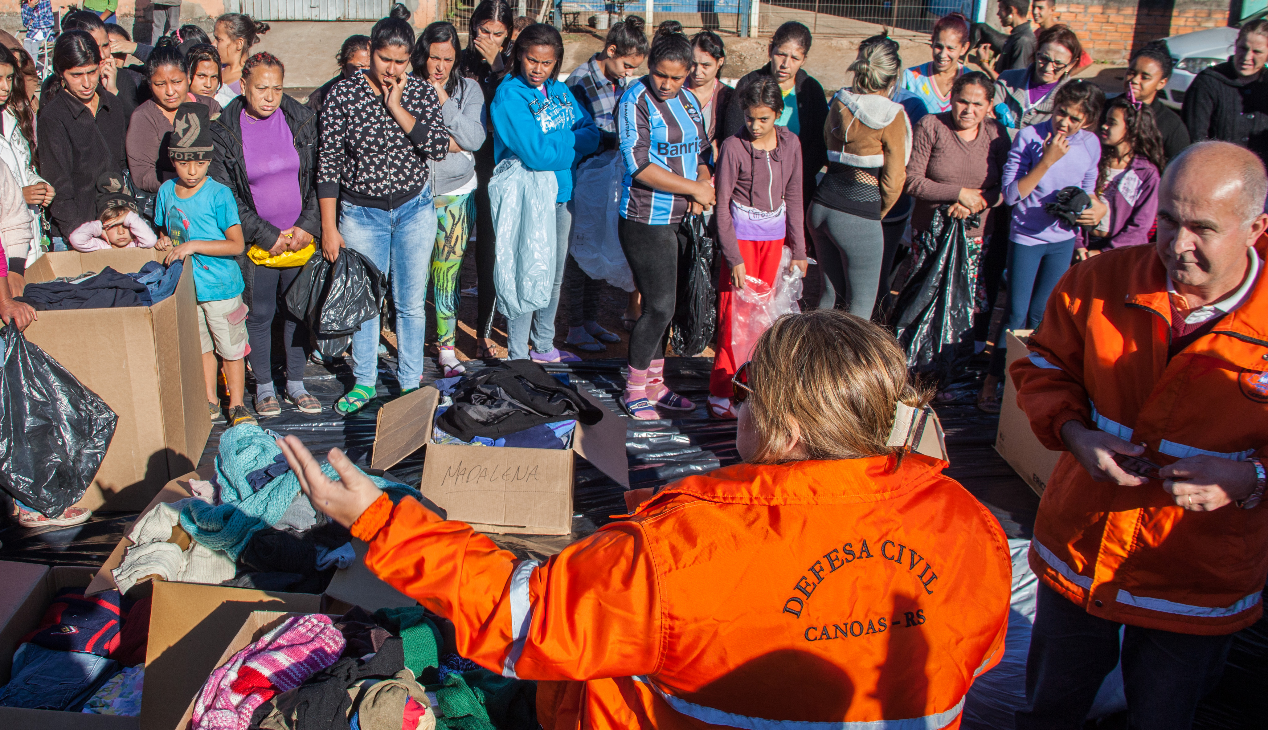
To support decision making in risk situations, GEOCANOAS has a webmap with relevant information for relief and prevention actions, such as schools, health facilities and hospitals, escape routes, areas of technological risk, among other variables that may be consulted interactively. It enables the strategic use of information by the city’s Civil Defense, and is open to the public allowing easy access to information.
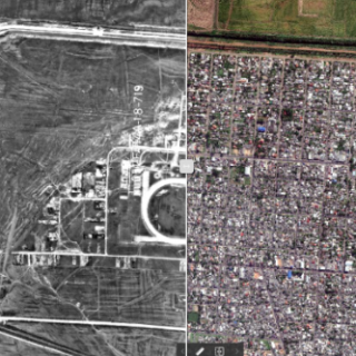
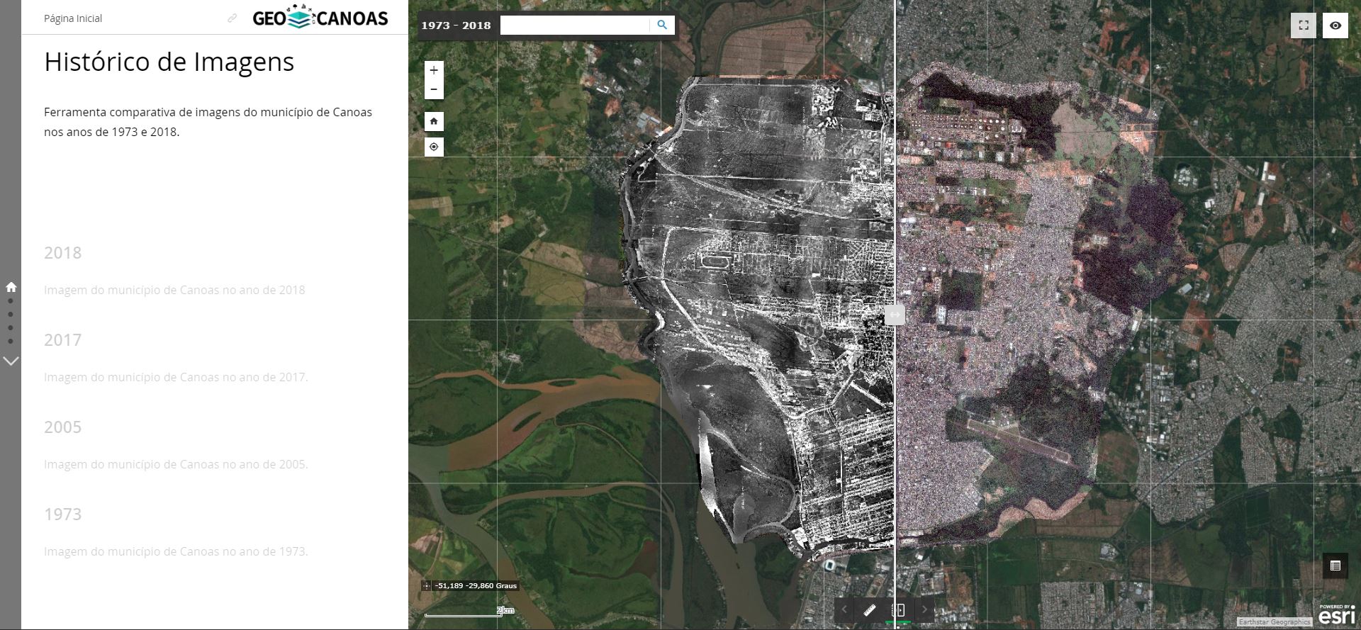
Joining with the other available images (1973, 2005, 2017 and 2018), we can verify trends of urban expansion, occupation patterns, and several other utilities, adapting to the area of study and research. In addition, the application can be used in the classroom by teachers and students in both basic and higher education.
Canoas has also been going through the gentrification process over the years, where changes in the urban space – with the help of the government or not – value land prices, resulting in the migration of traditional residents who normally cannot afford to stay in the countryside. local. The municipal management, using this instrument, can identify these transformations in the territory and carry out the urban planning according to the identified trends.
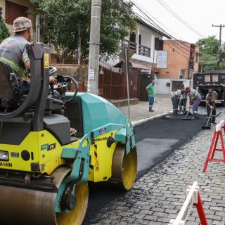
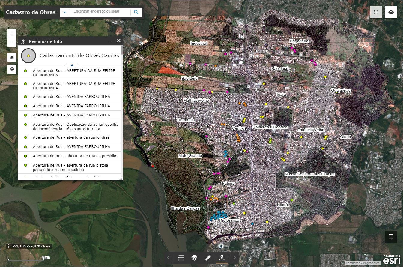
The data collected in the field are updated in real time on the map, allowing to view information such as the type of work performed, date of execution and images of the execution.
Monitoring is performed from data collected in the field by the site supervisor, who sends the georeferenced information through an application installed on your smartphone. The submitted data is updated on the map in real time, with information on type of work performed, date of execution and images of execution.
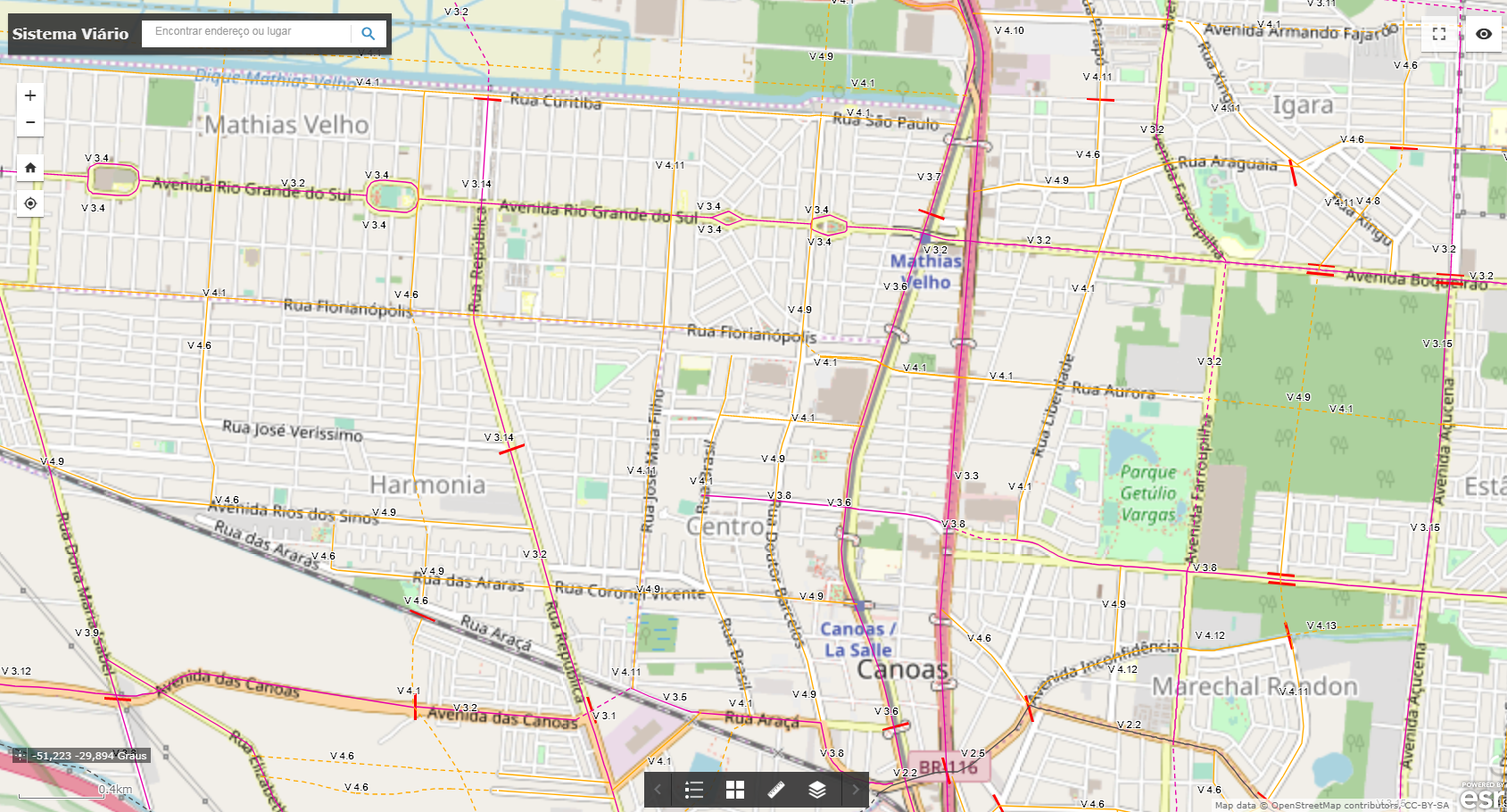
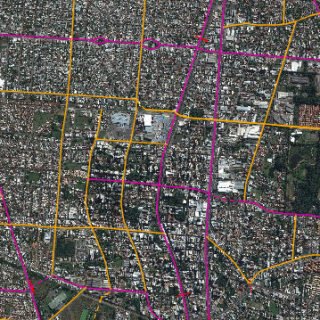
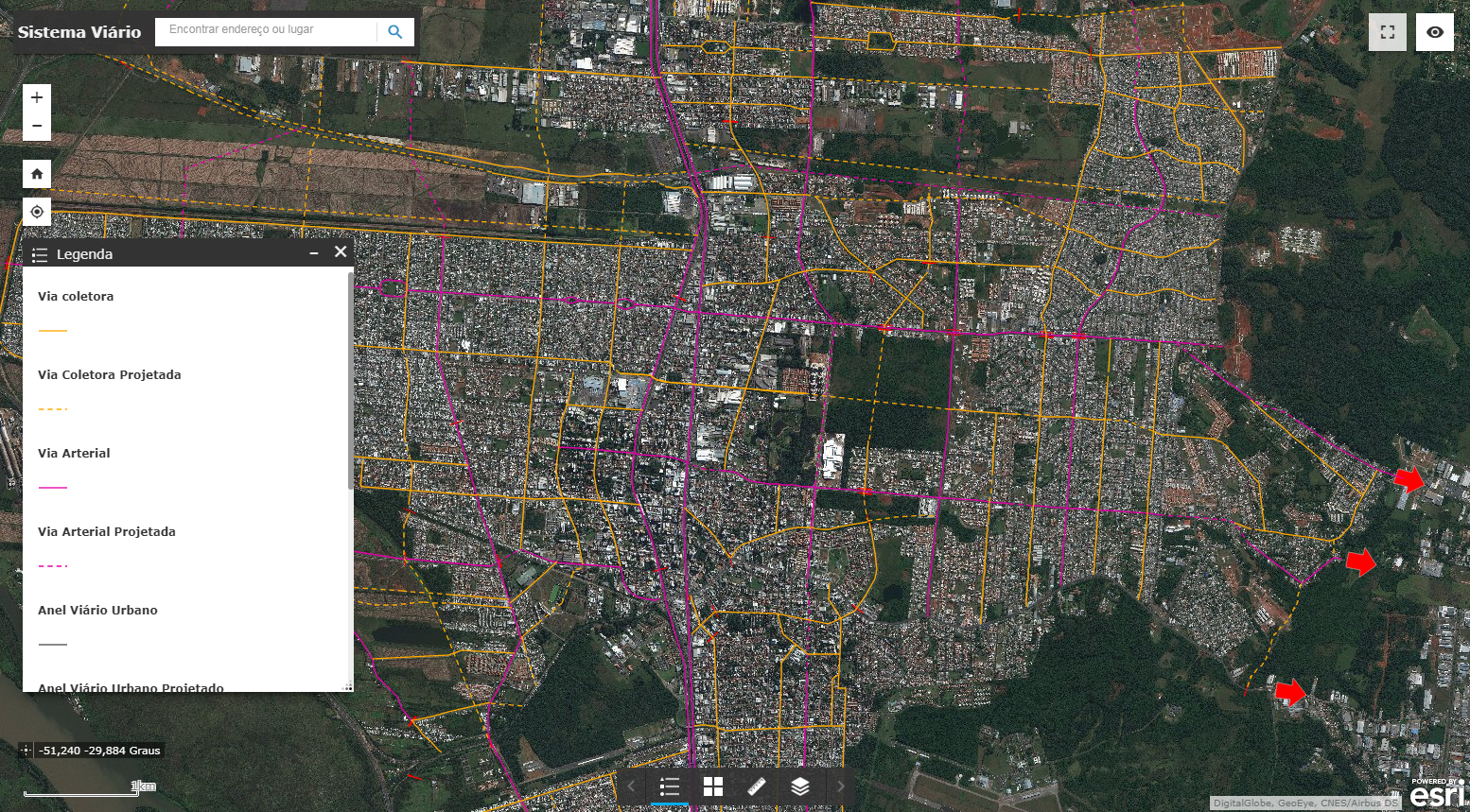
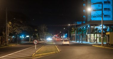
The city of Canoas has an extensive road network distributed in the 5 regions of the city, the application exposes the existing and projected roads, as well as their respective hierarchy according to the Urban Environmental Master Plan of 2015. It is used by management to develop strategies to improve the quality of movement of people and cargo within the municipality, in order to integrate modes and articulate the metropolitan road network.
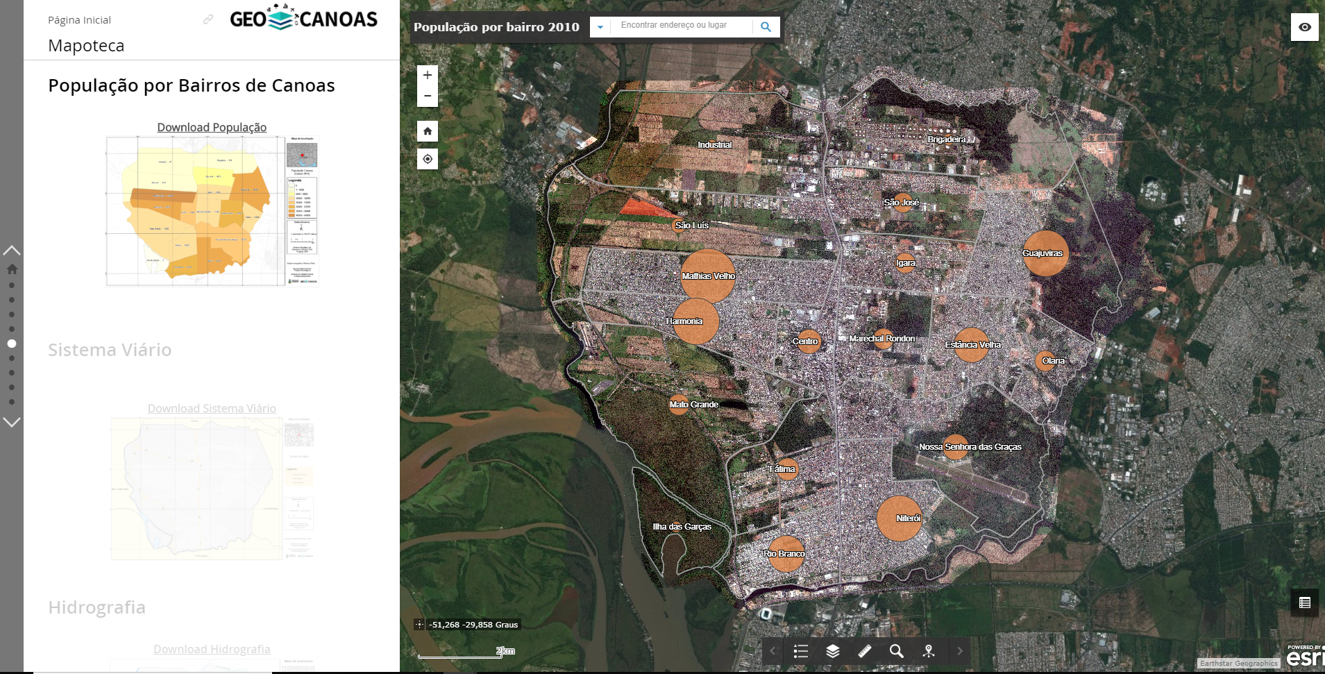
Map Library is a service that combines the concepts of a library and an online map catalog, addressing various themes through interactive maps and in PDF format for download and printing, and can be used even in schools in the region. Among the themes presented are the hydrography, city squares, subprefectures and neighborhoods of the municipality.
The available maps are of the road system, parks and squares, contribution basins, water resources, population by neighborhood, HDI in Rio dos Sinos valley cored, culture, bike paths, health map and Canoas by regions (subprefectures).
PLANNING CANOAS
Planning a city for the future, in the face of population, economic growth and the demands of urban mobility and other areas, is a challenge for public managers. In this sense, Geocanoas presents itself as a tool of great strategic importance for decision making, generating accurate data and metrics that also aim to provide managers with relevant information. In this sense, Geocanoas presents itself as a collaborative platform that helps in the sustainable growth of the city, as well as offering citizens more transparency and agility in public services.
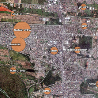
SOME PLACES WHERE GEOCANOAS ALREADY IMPACTED
RELATED NEWS
Geocanoas
/
/
GeoCanoas é modernizado e promove desburocratização do serviço público
Este site usa cookies para que possamos oferecer a melhor experiência de usuário possível. As informações dos cookies são armazenadas em seu navegador e executam funções como reconhecê-lo quando você retorna ao nosso site e ajudar nossa equipe a entender quais seções do site você considera mais interessantes e úteis.
O cookie estritamente necessário deve estar ativado o tempo todo para que possamos salvar suas preferências de configuração de cookies.
Se você desativar este cookie, não poderemos salvar suas preferências. Isso significa que toda vez que você visitar este site, precisará habilitar ou desabilitar os cookies novamente.